Saturday, December 10, 2011

Standard Chartered Marathon Singapore 2011: my second full marathon.

Standard Chartered Marathon Singapore medal front
Standard Chartered Marathon Singapore medal back


ChiRunning Simplified!, Efficient and Injury Free Natural Running Form Technique Video

Saturday, December 03, 2011

Monday, November 28, 2011

Penang Bridge International Marathon 2011 - Finally, my first full-marathon finisher.

Date: 20-11-2011
Time: 2am
Timing: 6'39"


Penang Bridge International Marathon 2011 medal front

Penang Bridge International Marathon 2011 medal back

Saturday, October 29, 2011

Gunung Tahan, 24 Oct 2011.

finally..after two nights camping along the ascent trek and hurling up 10kg of backpack.. on top of every mortal in Peninsula Malaysia at that moment..

Friday, September 09, 2011

Gunung Irau, 3 Sep 2011.

Ascent duration (with camping equipment): 4 hours to Mini Irau, another hour to Gunung Irau.
Descent duration: 4 hours.
Night temperature at summit (Mini Irau): 15 C
Water point: Nil
Amount of drinking water used: 1.5L
Difficulty: Moderate to tough, lots of climbing over tree roots, which will become slippery during rain (once I slipped and fell on the back during descent). Not for first-timer.

'Mini Irau'-some people call it false peak, may be in the past climbers thought they reached G Irau summit here. We camped here as it has nice flat and spacious area. From here to G Irau will take about an hour.

The famous mossy forest. Only a short stretch of the trail- about half an hour- are like this.
Mini Irau. On the left was where we came from the starting point after four hours of trekking, proceeded to the right to scale Gunung Irau, then back here again to pitch our tents. Notice the Pahang-Perak border pegs on the ground.


Thursday, September 08, 2011

Planning to hike Gunung Semangkok

(Facebook conversation)
 
Hamid: By the way when are you going to Semangkok? Never been there, myself. Don't mind tagging along if that's ok.

Me: I had researched terrain map of Semangkok yesterday and have few observations:
1. To go without guide if want to be adventurous.
2. I have been to part of the trail last time when I overshot the way to Pine Tree Hill, and found the trek recognizable but slight bushy due to ? lack of use
3. From the above map it shows the trek from PTH to Semangkok may take 6-8 hours, so either start from PTH early morning (camp there first), or pitch tent/hammock btw PTH and Semangkok.
4. Waterpoint. I have another JUPEM map that shows there are lots of stream left and right of the ridges, but still need to get down slope to search. I don't think we can possibly bring enough water from start point.
5. Need two GPS to avoid getting lost.
6. Not sure of need for permit.
7. Prepare to abort mission if trek becomes unpassable (though this is a state border and the pegs should be there).
Your comments pls..

Hamid: Doc, my humble opinion, we should get a guide.He should be able to show us the best campsite between PTH and Semangkok with or near water source. Trekking 5 to 6 hrs to Semangkok will be daunting enough without having to go up and down the ridge slopes to look for water. He too can help clear the bushy trek you mentioned. Should it be necessary to get permits and the likes, we can then ask him to settle it for us.
May be later, on a second trip, we'll be more confident to test our map reading and orienteering skill.

Me: Yea you are spot on, Hamid. Sounds very logical and sensible- from an experienced hiker, luckily I talk to you first, otherwise another repeat of getting lost like in G Irau haha.. In fact me and Mr Tan already hiked twice unguided- PTH and Irau, both quite eventful. So I will skip Semangkok for the mean time until we can sit down and work it out properly together, may be for next/ next next year's MNSJ outing. Can discuss it further during our Tahan train ride :-)

Wednesday, September 07, 2011

Common flowers along Gunung Irau summit trail

These are the commonly seen flowers along the Gunung Irau summit trail:

Impatiens oncidioides


Argostemma sp.

  Henckelia sp.
Sonerila rudis

Pulau Tinggi revisited. 13 Aug 2011.


One more dive, before the sun goes down and darkness blankets the sea.
One more try, witnessed by the sunset and frozen in time.
I don't want to leave, I just want to repeat. I am the Son of the Sea.

(Wee Soon Chit taking a plunge, captured by Gan Cheong Weei) 


Tuesday, June 28, 2011

Gunung Angsi, Negeri Sembilan, 26Jun2011

This was the place we parked our cars along the old trunk road of Seremban- Kuala Pilah, near to Ulu Bendol recreation park. The trail we used was different from my previous hike, which started from the park admin office. 

The ascend was 3 hours, and descent 2.5 hours. A short stretch of the trail passed through thick resam (Dicranopteris linearis, or Tangle Fern, False Staghorn-fern, Umbrella Fern) vegetation where we received scratch cuts if not wearing long sleeves and long pants. 

Mr Tan and Mr Soh relaxing before the climb.

On the left is Mr Chong, from NS Trekkers, who introduced this new trail to us. Aili, Jessie and Surjit were at the middle. 

The trail head was marked yellow in the photo above. About one hour on the way up we came across one of the kind 'rest and rescue' stop where beverages, titbits, resting chairs, log stools, chinese oldies songs etc were provided by a trekking enthusiast turned volunteer called Panjang, who didn't mind receiving some token donation for whatever we consumed. Just to be at this R&R was worth the effort for the hike.

Monday, November 22, 2010

A failed attempt at full marathon: Penang Bridge International Marathon 2010

The left knee pain was excruciating at 36km when the traffic police passing by. He waved me to go up the sweeper bus of Rapid Penang, saying the distance to finishing line at Queensbay Mall is still far.

Under normal circumstances it would take me about an hour to run the remaining 7km, now to complete the race with a limp it would definitely take more than two hours, and I still had a home bound bus to catch at Butterworth and needed to cross the Penang Channel in the ferry. So I hopped on the bus broken-heartedly!

In the bus there were a few full marathon participants already inside, most of them were young runners who looked less than 50 years old just like me. The older runners were still running and already near the finishing line. I think they were far more experienced and prepared.

When the sweep bus approached Queensbay Mall, I looked at the long span of Penang Bridge and was surprised I actually ran to and fro on it few hours ago. Although a little bit proud, this was no consolation to the strong feeling of shame of not being able to complete the journey- not even by crawling at the last miles!


The sweeper bus stopped near the Mall for everyone to alight. To our surprise one runner in the bus got down and start running among those approaching the finish line. At that moment it was near to 7 hours completing time. Was he going to claim the finishing medal and thus cheating himself and the rest of the world? For the rest of us we still had a few ounces of honesty- if not running stamina- left so we got down and walked the side way towards Eastin Hotel and runners tent, with that unmistakable injured runners’ gait which quite resembled a duck walking in running shoes!

Around finishing line and Queensbay Mall there were many full marathoners moving around with sunshine smiles and the glittering gold Finisher medal hanging round their neck. I congratulated each one of them, shaking hands, and chatted on my failed attempt and pointed to them my injured side of left knee. They all graciously encouraged me to come again next year and try once more, to which I answered with a halfhearted “ok, hopefully, will see first”.

If I ever try it again, I will pay more attention to weight training so as to strengthen my knees. The same problem cropped up in my previous mountain climbing trips. The Penang Bridge marathon route was similar to mountains. We have a few rise up sections at the Bridge and along Jelutong Expressway, there were where I picked up the ligament sprain.


Wednesday, June 23, 2010

Gunung Batu Puteh, Perak. 19~21 June 2010

The white rock was mystified behind the midday thick dancing cloud, 
all of us anticipated silently like a pilgrim at Batu Kak,
eyes unwaveringly fixating forward, 
for that sudden revelation of timeless beauty..
- T.H.
 
Gunung Batu Putih,2131 meter, is the eighth highest mountain in Peninsular Malaysia. This is the highest mountain I climbed besides Gunung Ledang and Mt Kinabalu. One only needs good stamina to complete the hike to the summit which takes 2 days at easy pace, and certain muscle strength to carry an average of 10kg backpack.


Orang asli village, not far from the trail head.


River crossing at "Sungai Y", a confluence of two tributaries of Sungai Woh. The current is strong and the rocks slippery, a wrong foot step will send one and his/her backpack to a good dip- if not being swept away.


Jungle path. We walked an hour to reach 'Sungai Y'.


Our organizer, Encik Hamid, doing stretching exercise in the morning after the first night camping. Dr Joy Mak can be seen massaging her aching thighs, while Zainal Abidin was putting his socks, and Aishah busy taking some amusing snap shots.


Boon Siong in Gua Azan cave, our second night lodging. It is a huge boulder overhanging, quite airy and we don't need to use tents. At night the temperature was recorded at 18 deg.C.


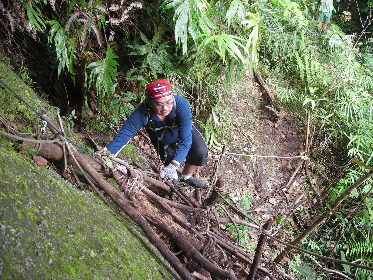
Zainol climbing up wooden scaffolding over rock face to reach Batu Kak.


Fairytale-like mossy forest near the summit.


A well-earned slumber at 5:15pm, after pushing hard to reach summit before dark. Still, on the way down I had to grope in the dark with headlamp on slippery terrain in the drizzling rain- the result was countless bottom ground hits.


Kudos to all the team members- you made the trip so memorable and fun. I hope one day we can go climbing once again. For that particular one with poor fitness level and common sense, he has to buckle up or else nobody is willing to go with him anymore haha..

Monday, June 14, 2010

Gunung Angsi, 5 Jun 2010

Starting time: 9:45am
Summit: 1:30~2:00pm
Ending time: 4:30pm 
All photos courtesy of Aili Piong.